Knowing all the places you’ve visited in the world is great but not like seeing them right in front of you across a map. Or at work, understanding approximately where your customers or suppliers are is also great. Maybe you aren’t quite sure of them all though. Seeing them across a map, for that ‘picture is worth a thousand words’ effect, is fabulous. Given most photography hardware captures GPS locations, this should be easy and should be regularly available. Facebook used to have a map view of your uploaded photos, but that feature has been removed for reasons unknown. To demonstrate how useful being able to map numerous items across a map is, be it vacation or customers, below are two screenshots from DBGallery. Figure 1 shows one photos from each place I’ve visited as I explore this wonderful world of ours. Figure 2 shows locations of a list of DBGallery customers as of 2015.

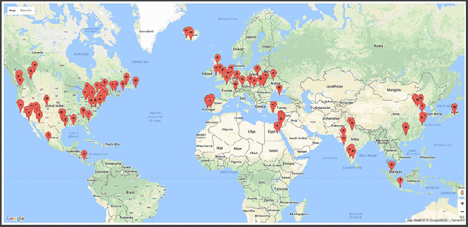
Figure 1: My personal travel map (as of June 2018). To do this, the DBGallery image management software ties into the Google Maps API. (click for a larger image)
The map above is near and dear to my heart. It maps out the many places I’ve traveled for both business and personal reasons over the years. And world travel has always been one of I’ve always wanted to see the across a map…all at once! To do so dropped one photos from each place into a Virtual Set within DBGallery, then chose the View as a Map option. It’s a beautiful thing! Now as I want to zoom in for a closer look at the specific Middle East locations, I simply double click near there and DBGallery zooms there. Click a marker and the photos shows up. I find it a great way to re-travel the parts of the world I’ve visited all over again, wallowing in many wondrous memories. Showing them all across a maps has also pointed out that I seem to have a very northern hemisphere bias as well. Like wow, only one marker below the equator! Time to get moving further south.

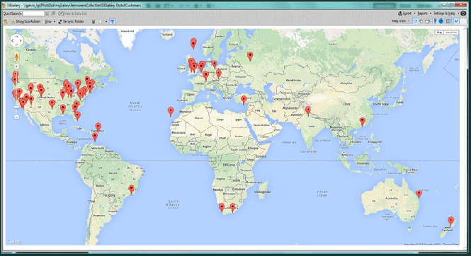
Figure 2: DBGallery Customer Map, circa 2015. (click for a larger image)